Historical Maps & The Oregon Trail
The world has changed over time. The names and boundaries of some states and countries have changed. Routes have changed, too. Some maps tell about places in the past. These maps are called historical maps. They help us to learn how the world used to be.
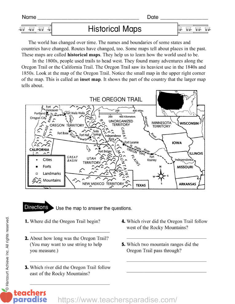
In the 1800s, people used trails to head west. They found many adventures along the Oregon Trail or the California Trail. The Oregon Trail saw its heaviest use in the 1840s and 1850s. Look at the map of the Oregon Trail. Notice the small map in the upper right corner of the map. This is called an inset map. It shows the part of the country that the larger map tells about.


WORKSHEET & Sample PDF Activity
Sample PDF Activity
Directions Use the map to answer the questions about Historical Maps & The Oregon Trail
- Where did the Oregon Trail begin?
- About how long was the Oregon Trail? (You may want to use string to help you measure.)
- Which river did the Oregon Trail follow east of the Rocky Mountains?
- Which river did the Oregon Trail follow west of the Rocky Mountains?
- Which two mountain ranges did the Oregon Trail pass through?