ROYLCO INC. Dry Erase USA Map Class Pack R-59091
$14.99
Out of stock
Brand:
Roylco®
Description
Ages 6
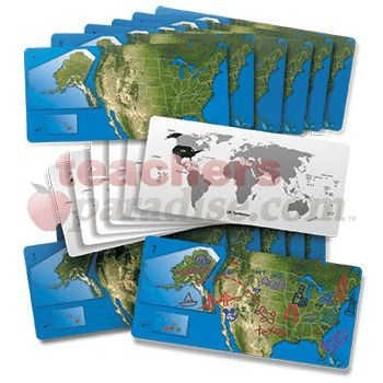
Gain a sense of the beauty of American geography! The United States is represented by a satellite view of the country with insets of Alaska and Hawaii to scale. We’ve drawn in each state. Use the maps to identify the States and their capitals. Draw landmarks and geographical formations! On the reverse side, take a look at the entire world and the position of the United States and it’s territories on the globe. Maps are 5 x 11″ (13 x 28 cm). Includes teacher guide. 24 American dry erase maps. by ROYLCO INC.
Related Products
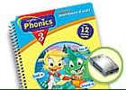
Phonics Book #3 A Day at Moss LakeIt's a party! Leap, Lily and Tad are off to Moss Lake for ...

This engaging series covers the basics of science instruction for grades 1-6. It provides informative readings and worksheets on a ...
Die-Cut Magnets, Superhero, 10 pcs. Multi-purpose labels have a write-on/wipe-off face and magnetic back. Use on dry erase boards and ...
Pocket Chart Inserts feature a heavy-duty, write on/wipe-off surface. No lamination needed. Use with dry erase or water based markers ...
For turf and grass striping...Will not wash off in the rain or harm the grass...Twelve 18 oz. cans of white ...
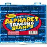
Kids love stamps and you'll love what they learn! Tracing stamps teach students to form letters correctly. Letters measure 1" ...
Super strong bins are ideal for storage in the classroom. Indoor use only. Non-toxic and impact resistant. Matching lids sold ...
These pads are wonderful for large rubber stamps as well as child "hand print" decorating and mementos. Acid-free and archival ...